 Utility Specialist
Powered by Utility Specialists of America
Utility Specialist
Powered by Utility Specialists of America
Utility data services powered by field experience and The Utility Specialist.
From joint-use audits to storm response — each service replaces scattered photo folders and manual spreadsheets with a reviewable, export-ready corridor record. And when it's time to build, our crews deliver directional drilling and overhead construction under the same roof.
Order the outcome your project needs.
Joint-use attachment audit
Corridor-wide attachment inventory cross-checked against permitted records, with flags for unauthorized or disputed attachments.
Revenue recovery & complianceUnauthorized attachment review
Photo-backed evidence packages help utilities resolve differences between the ledger and the pole.
Owner & attacher evidenceFiber make-ready feasibility
Per-pole route findings show likely space availability, make-ready needs and replacement risk before construction surprises land.
PoleForeman & SPIDA-readyCompare & verify
Before and after route passes line up by position so completion status is based on matched imagery.
Close-out proofDouble-wood transfer remediation
Track old-pole removals, open transfers, owner responsibility and completion evidence across a corridor.
Punch-list controlPost-storm damage assessment
Capture downed, leaning, broken or at-risk assets with dated, located imagery for restoration and reimbursement.
Storm response evidenceStreetlight inventory
Reconcile visible streetlight fixtures, condition flags and location data against billing and asset records.
Asset & billing alignment360° mapping & design support
Field surveys, area mapping, route context and cost-estimation support for dry utility planning.
Design-ready contextConsulting & advisory
Project profiling, due diligence, feasibility, workflow optimization and technology implementation support.
Strategic supportEnd-to-end infrastructure solutions.
Smarter data. Stronger infrastructure. We pair AI-powered mapping with expert field execution — the partner that surveys your corridor can also put utilities in the ground and on the pole.
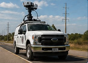
AI-powered mapping & asset intelligence
Our software captures 360° imagery and analyzes utility assets with AI, delivering accurate, real-time data you can trust.
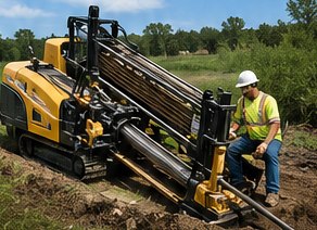
Horizontal directional drilling
Minimize surface disruption and cross obstacles with precision and efficiency.
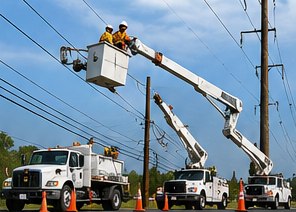
Overhead aerial infrastructure
Complete overhead construction, maintenance and upgrade services for utilities and telecom providers.
Eyes overhead where the truck can't reach.
Drone mapping complements the 360° capture car — documenting spans, pole tops, and storm damage from above, all folded into the same corridor record.
A simple chain from field capture to usable deliverable.
Capture
Vehicle-mounted 360° imagery and RTK positioning document the corridor, with drone support for hard-to-reach assets.
Detect
AI-assisted tools surface likely assets and issues without exposing the internal detection approach.
Review
Our reviewers confirm the items that matter and preserve the evidence trail.
Deliver
Reports, data files, work-item status, before/after proof and engineering handoff packages, ready to use.

Have a corridor, punch list, or storm window?
We'll shape the right service package around the decision you need to make.
Request a project review →