 Utility Specialist
Powered by Utility Specialists of America
Utility Specialist
Powered by Utility Specialists of America
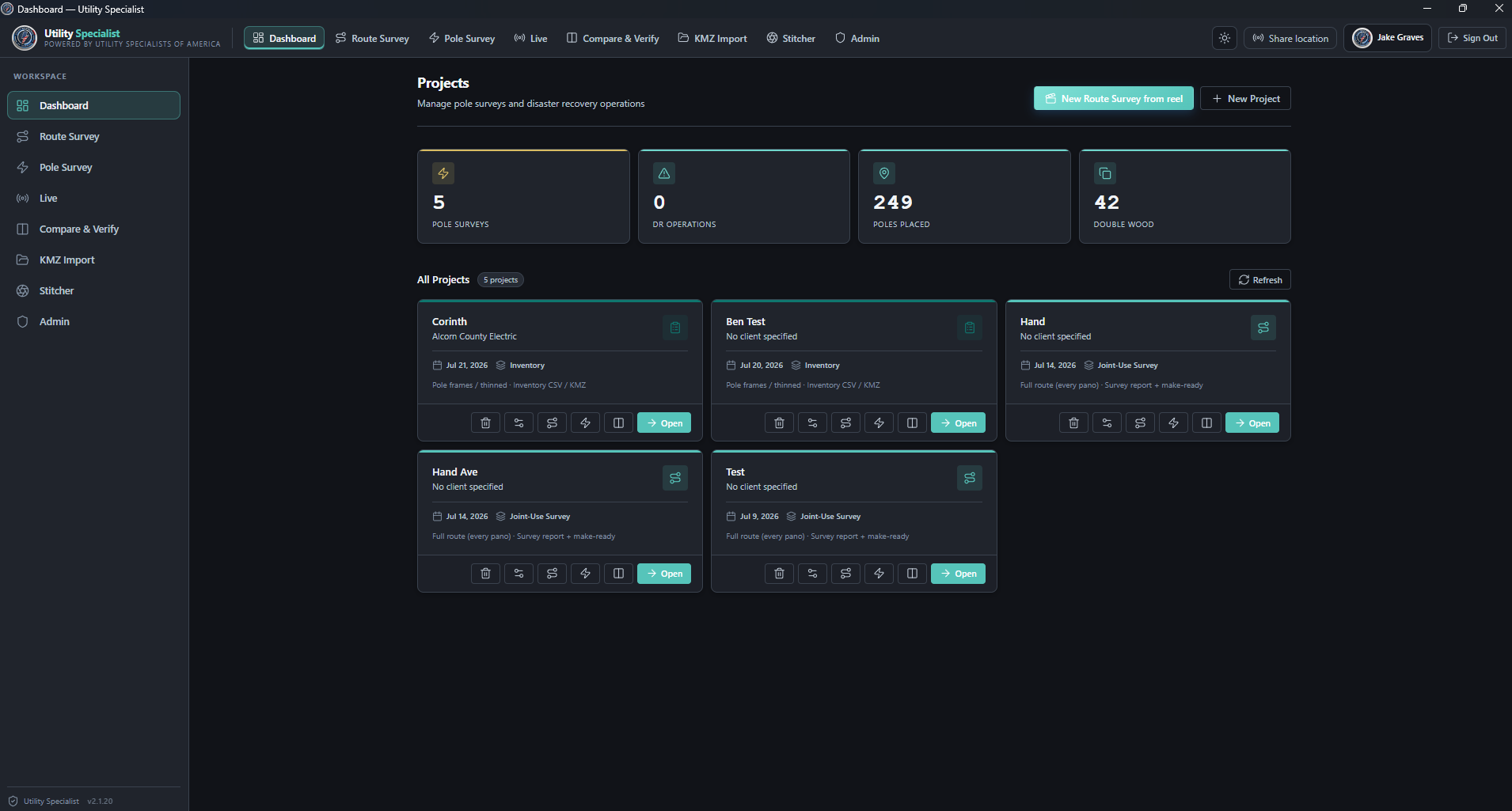
The Utility Specialist organizes the field record from capture through close-out.
One platform connects 360° route imagery, pole review, before/after verification, imports, exports, and project evidence — so the survey record moves cleanly from the field to the office.
A workflow built for utility corridors.
Not a generic file viewer — it's built around the jobs utility teams repeat: review the route, confirm the asset, compare the work, export the result.
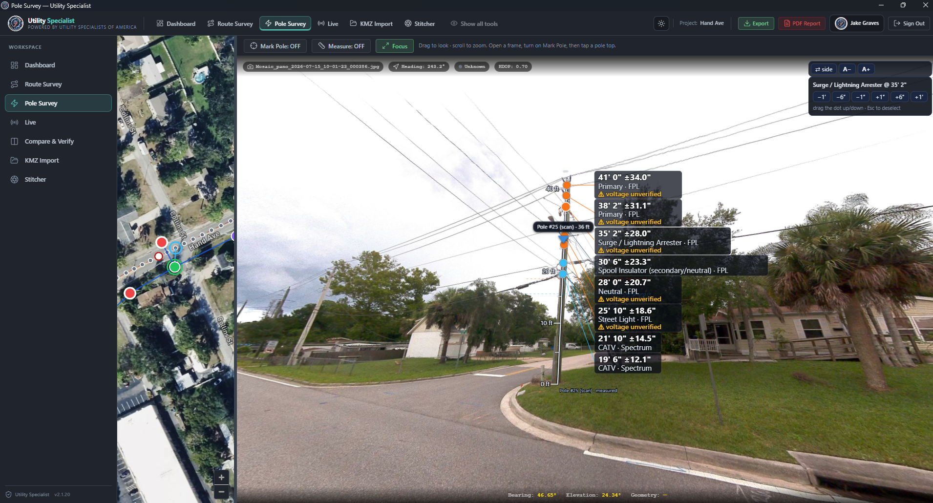
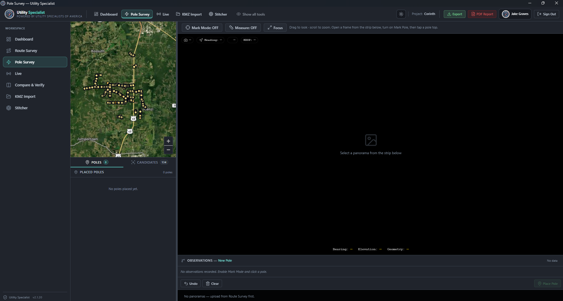
Evidence, context, and clean handoffs.
The platform presents exactly what customers and reviewers need: imagery, map positions, work-item state, confidence signals, user decisions, and deliverable exports — while the proprietary capture processing and review logic stay internal.
Book a demo →Practical software for the field-to-office chain.
360° route review
Navigate captured corridors with visual context and map awareness.
AI-assisted candidates
Candidate queues focus review on likely poles, fixtures and issues.
Human confirmation
Keep deliverables accountable with reviewer decisions, evidence and state.
Before/after matching
Compare re-driven corridors against the baseline record to prove completion.
Offline-friendly desktop flow
Desktop capture and processing support field ops when connectivity is imperfect.
Export-ready packages
Package evidence and structured data for business, GIS and engineering teams.
The output is built for the next decision.
Export to virtually any deliverable your team needs — industry-standard formats, not just CSV and KMZ.

Bring your route or workflow question.
We'll map the right deliverable package from The Utility Specialist — without exposing the internal processing that makes it work.
Talk through a project →